Jennifer Henning's German Genealogy Site

Let me know if we are researching the same people or places.


Name and place indexes for this entire web site.

Information on just this family and region.

Introduction to this web site.
Copyright ©2005-2018 by Jennifer Henning
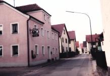
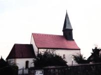
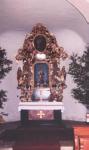
Grossetzenberg
(Earlier sometimes Etzenberg)
Kreis Regensburg, Bayern
(Click on picture for larger image)
Related Families in Grossetzenberg
Navigation
Let me know if we are researching the same people or places.
Name and place indexes for this entire web site.
Information on just this family and region.
Introduction to this web site.
This page created August 19th, 2005, updated September 28th, 2015, last edited March 10th, 2018
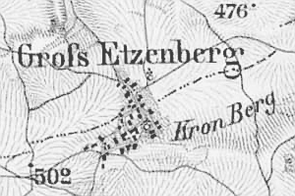
Kreis Regensburg, Bayern
(Click on picture for larger image)
| |
| To zoom out to a larger area map click here. | |
|---|---|
Map dates from 1887, updated 1910. It covers an area of approximately 1.3 by 0.8 km (0.8 by 0.5 US miles).
Map image was adapted from Topographischen Bureau des K.B. 1:50K, sheet 48 (Regensburg West)
The following table shows which of the individuals included in this web site are connected to Grossetzenberg and over what time span they are found here.
| Surname | Given names and the range of dates the person was found in Grossetzenberg |
|---|---|
| Dinauer / Dünauer |
 Maria Eva 1768..1779 Maria Eva 1768..1779 |
| Emerl |
Catharina 1808..1814 |
| Karl |
Johannes Evangelist Jacob 1838..1849 |
| Metz |
 Jacob 1871Johann 1873Johann Friedrich 1861..1874Theresia 1874 Jacob 1871Johann 1873Johann Friedrich 1861..1874Theresia 1874 |
| Rappl |
Casper 1803 |
| Sinzinger |
 Anna Maria 1808Barbara 1840Catharina 1810..1849Conrad 1768Georg 1779Johann Baptista 1847..1873Johann Georg 1763..1806Josef 1849Joseph 1770..1810Maria Barbara 1774Theresia 1838Walburga 1881Wolfgang 1843 Anna Maria 1808Barbara 1840Catharina 1810..1849Conrad 1768Georg 1779Johann Baptista 1847..1873Johann Georg 1763..1806Josef 1849Joseph 1770..1810Maria Barbara 1774Theresia 1838Walburga 1881Wolfgang 1843 |
| Weber |
Margaretha 1869..1874 |