Jennifer Henning's German Genealogy Site

Let me know if we are researching the same people or places.


Name and place indexes for this entire web site.

Information on just this family and region.

Introduction to this web site.
Copyright ©2005-2021 by Jennifer Henning
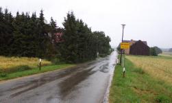
Mantlach
Kreis Kelheim, Bayern
(Click on picture for larger image)
Related Families in Mantlach
Navigation
Let me know if we are researching the same people or places.
Name and place indexes for this entire web site.
Information on just this family and region.
Introduction to this web site.
This page last updated September 28th, 2015, edited January 23rd, 2021
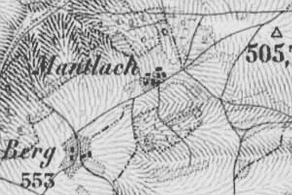
Kreis Kelheim, Bayern
(Click on picture for larger image)
| |
| To zoom out to a larger area map click here. | |
|---|---|
Map dates from 1887, updated 1904. It covers an area of approximately 1.3 by 0.8 km (0.8 by 0.5 US miles).
Map image was adapted from Topographischen Bureau des K.B. 1:50K, sheet 47 (Dietfurt Ost)
The following table shows which of the individuals included in this web site are connected to Mantlach and over what time span they are found here.
| Surname | Given names and the range of dates the person was found in Mantlach |
|---|---|
| Metz |
 Alois 1877..1902Alois 1907Anton 1875Barbara 1878Georg 1881..1912Jakob C 1876Johann Friedrich 1875..1905Josef 1879Karl 1885Margaretha 1882Maria 1906Theres 1909Walburga 1911 Alois 1877..1902Alois 1907Anton 1875Barbara 1878Georg 1881..1912Jakob C 1876Johann Friedrich 1875..1905Josef 1879Karl 1885Margaretha 1882Maria 1906Theres 1909Walburga 1911 |
| Preis |
Walburga 1906..1911 |
| Weber |
Margaretha 1875..1885 |