Mitch Blank's North-German Genealogy Site
Mitch Blank
Groß Lukow
Kreis Waren, Mecklenburg-Schwerin
Navigation
Copyright ©1998-2017 byThis page created December 21st, 2008, edited February 24th, 2017
Kreis Waren, Mecklenburg-Schwerin

| |
| To zoom out to a larger area map click here. | |
|---|---|
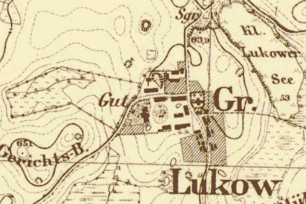
Map dates from 1885, updated 1911. It covers an area of approximately 1.3 by 0.8 km (0.8 by 0.5 US miles).
Map image was adapted from 1:25K Prussian Landsaufnahme, page 2444