Mitch Blank's North-German Genealogy Site

Let me know if we are researching the same people or places.

Name and place indexes for this entire web site.

Information on just this family and region.

Introduction to this web site.
Copyright ©1998-2017 by Mitch Blank
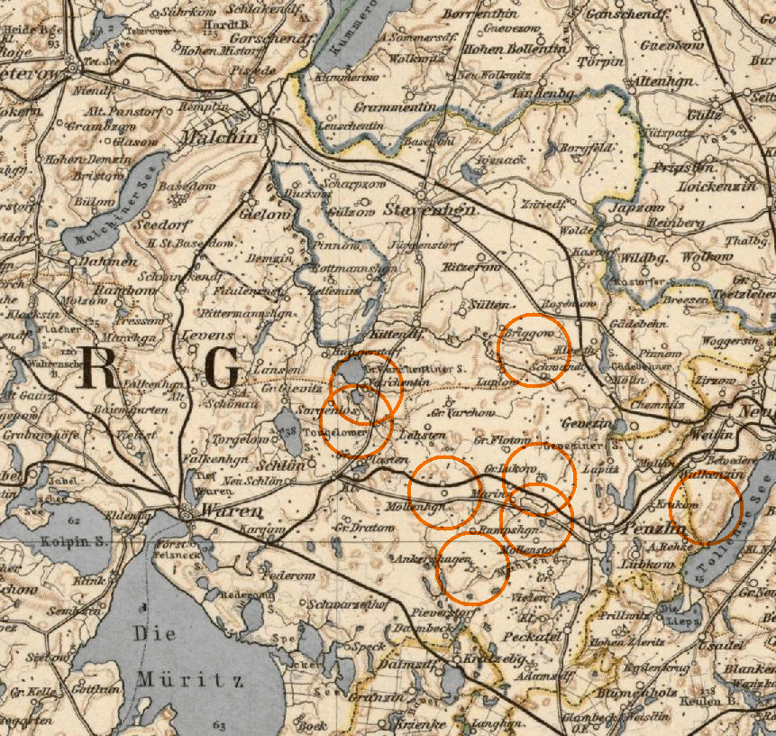
South-east Mecklenburg
Navigation
Let me know if we are researching the same people or places.
Name and place indexes for this entire web site.
Information on just this family and region.
Introduction to this web site.
This page created December 21st, 2008, updated March 31st, 2009
| ||||
| To zoom out to a larger area map click here. | To zoom in to a more detailed map, click within any Gold Circle on the above map. | |||
|---|---|---|---|---|
Map dates from 1892. It covers an area of approximately 47 by 45 km (29 by 28 US miles).
Map image was adapted from Sheet 8 (Schwerin), 1:500000 Karte des Deutschen Reichs