Jennifer Henning's German Genealogy Site
Jennifer Henning
Anger
Kreis Regensburg, Bayern
Related Families in Anger
Navigation
Copyright ©2005-2016 byThis page last updated April 3rd, 2014, edited October 12th, 2016
Kreis Regensburg, Bayern

| |
| To zoom out to a larger area map click here. | |
|---|---|
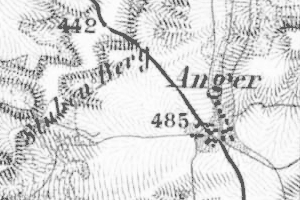
Map dates from 1887, updated 1904. It covers an area of approximately 1.3 by 0.8 km (0.8 by 0.5 US miles).
Map image was adapted from Topographischen Bureau des K.B. 1:50K, sheet 47 (Dietfurt Ost)
The following table shows which of the individuals included in this web site are connected to Anger and over what time span they are found here.
| Surname | Given names and the range of dates the person was found in Anger |
|---|---|
| Dinauer / DŁnauer |
 Georg 1706..1728 Georg 1706..1728 Johann Georg 1706..1741 Johann Georg 1706..1741 Maria Eva 1741 Maria Eva 1741 |
| Elmauer |
 Anna Maria 1741..1755 Anna Maria 1741..1755 |
| Niedermeier |
 Johann 1735..1779 Johann 1735..1779 Maria Agnes 1735 Maria Agnes 1735 |
| Scheid |
 Maria Barbara 1735..1779 Maria Barbara 1735..1779 |