Mitch Blank's North-German Genealogy Site

Let me know if we are researching the same people or places.


Name and place indexes for this entire web site.

Information on just Western Mecklenburg.

Introduction to this web site.
Copyright ©1998-2017 by Mitch Blank
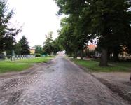
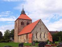
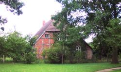
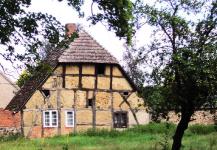
Dambeck
Kreis Ludwigslust, Mecklenburg-Schwerin
(Click on picture for larger image)
Related Families in Dambeck
Navigation
Let me know if we are researching the same people or places.
Name and place indexes for this entire web site.
Information on just Western Mecklenburg.
Introduction to this web site.
This page created March 31st, 2006, updated August 6th, 2010
Kreis Ludwigslust, Mecklenburg-Schwerin
(Click on picture for larger image)
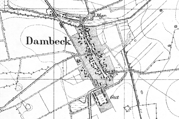
Map dates from 1881, updated 1924. It covers an area of approximately 2.5 by 1.7 km (1.6 by 1.1 US miles).
Map image was adapted from 1:25K Prussian Landsaufnahme
The following table shows which of the individuals included in this web site are connected to Dambeck and over what time span they are found here.
| Surname | Given names and the range of dates the person was found in Dambeck |
|---|---|
| Grünewalt / Grünwald |
 Ilsabe Christina 1747 Ilsabe Christina 1747 |
| Niedten |
Anna Sophia 1749 |
| Törckeln |
 Dorothea 1679..1747 Dorothea 1679..1747 |
| Winterfeld(t) |
 Erdmann 1685..1745Joachim 1678..1711Jochim 1682Johan Fridrich 1693Lorenz 1679Margaretha 1690Mari 1696Peter 1689..1731 Erdmann 1685..1745Joachim 1678..1711Jochim 1682Johan Fridrich 1693Lorenz 1679Margaretha 1690Mari 1696Peter 1689..1731 |