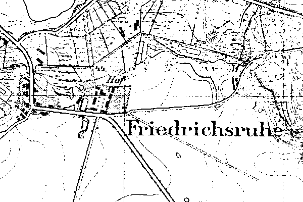
Kreis Parchim, Mecklenburg-Schwerin

| |
| To zoom out to a larger area map click here. | |
|---|---|
Map dates from 1881, updated 1904/1919. It covers an area of approximately 1.9 by 1.3 km (1.2 by 0.8 US miles).
Map image was adapted from 1:25K Prussian Landsaufnahme, page 2436
The following table shows which of the individuals included in this web site are connected to Friedrichsruhe and over what time span they are found here.
| Surname | Given names and the range of dates the person was found in Friedrichsruhe |
|---|---|
| Borchert / Borchar(d/t) / Borcherdt |
 Hans Carl 1839..1875 Hans Carl 1839..1875 |
| Freude |
 Magdalena Dorothea 1787..1789 Magdalena Dorothea 1787..1789 |
| Machenlüb |
 Dorothee 1788 Dorothee 1788 |
| Pietschmann |
 Sophia Christiana Elisabeth 1867..1874 Sophia Christiana Elisabeth 1867..1874 |
| Rudolf / Rudolph |
 Hanna Dorothea Sophia 1787 Hanna Dorothea Sophia 1787 Heinrich Christian 1787..1789 Heinrich Christian 1787..1789 Johann Christian 1789 Johann Christian 1789 |
| Warnke / Warncke |
 Carl Friedrich 1788 Carl Friedrich 1788 Cord 1715 Cord 1715 |